Section or Grid Maps
Maps can be done for all of your response districts.
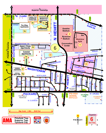
Your maps can show square mile sections or specific areas of your district.
Are your current maps readable at 0300 in a fire truck?
Do your current maps include:
All the latest revisions, not months or even years old!
All new streets, including plotted ones!
Business addresses and locations.
Links to site specific drawings
The drawings can include such things as:
New Sub divisions
Block numbers
Individual addresses
Business locations
Bridge restrictions
Special notes
Landmarks
Hydrants